Numerical Terradynamic Simulation Group
Welcome to the NTSG
The Numerical Terradynamic Simulation Group (NTSG) operates as a Research Center of Excellence under the University of Montana (UM) Office of Research & Creative Scholarship. Founded in 1987 within the UM College of Forestry & Conservation, NTSG is a nexus for UM research and technology development in satellite remote sensing and Earth system science. Our primary mission is to advance knowledge of ecosystem structure, function & resiliency through emerging technologies in remote sensing & computational modeling, grounded in the biophysical sciences. Our facilities are located on the 4th floor of the Interdisciplinary Science Building (ISB) on the UM campus.
Recent Science Highlights
Arthur Endsley heads NASA Open Science Project at University of Montana
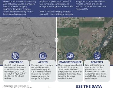
New Landscape Explorer tool released to assist natural resource conservation in the western US
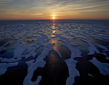
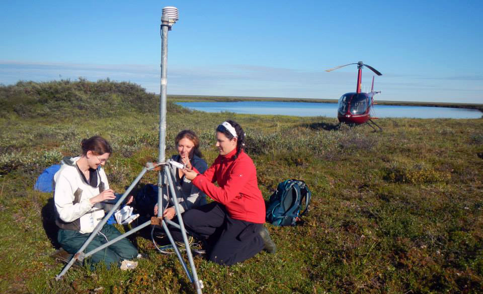
Warming temperatures are turning permafrost regions into carbon sinks, research suggests
NTSG Publications
- Widespread deepening of the active layer in northern permafrost regions from 2003 to 2020
- Fire needs annual grasses more than grasses need fire
- Mapping tree cover expansion in Montana, USA rangelands using high-resolution historical aerial imagery
- Continuity of Global MODIS Terrestrial Primary Productivity Estimates in the VIIRS Era Using Model-Data Fusion
- Widespread spring phenology effects on drought recovery of Northern Hemisphere ecosystems
- Intensified warming and aridity accelerate terminal lake desiccation in the Great Basin of the western United States
- Herbaceous production lost to tree encroachment in United States rangelands
- Pan-Arctic soil moisture control on tundra carbon sequestration and plant productivity
- GLOBAL ARIDIFICATION AND THE DECLINE OF NPP: A COMMENTARY on Projected increases in global terrestrial
net primary productivity loss caused by drought under climate change. - Respiratory loss during late-growing season determines the net carbon dioxide sink in northern permafrost regions
NTSG Data Products
NTSG supports several NASA satellite Earth missions and is a leader in developing operational algorithms, data products and science applications for these missions. We are a NASA Earth Science Information Partner(ESIP), developer and repository for a variety of global land data products from satellite Earth missions, including MODIS (MOD16/17) vegetation productivity and evapotranspiration, AMSR land parameters, and SMAP (L4C) carbon flux products. Access our data through the Projects and Data page.
Research Students
NTSG teaching/instruction emphasizes research training for postdocs and GRAs in the skills needed to become effective research scientists in ecological remote sensing and modeling. These skills include writing competitive research proposals; writing and publishing research papers in peer-reviewed literature; application of geospatial software and computer programming for processing and analyzing large global satellite datasets; management of interdisciplinary research projects and field campaigns. We provide our GRAs and postdoctoral scholars with state-of-the-art remote sensing data and science computing facilities; opportunities for travel, science leadership, and networking, and presenting their work at national and international workshops. For additional information on:
- Graduate Research Assistance positions email NTSG at info@ntsg.umt.edu
- Postdoctoral applications are found on the NTSG Jobs page
- Current class information is found on the NTSG Teaching page