
Landsat NDVI
Project Summary
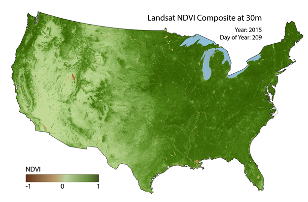
We've developed unique approaches to creating and distributing spatially continuous NDVI composites using Landsat imagery for the conterminous United States. NDVI is one of the most widely used vegetation indices with applications in ecology, forestry, agriculture, wildlife and other disciplines. Landsat derived NDVI for ecological applications is limited, however, due to the infrequent return interval of Landsat satellites, probability of cloud cover and atmospheric contamination, temporal offsets between adjacent scenes, and various sensor malfunctions. Our compositing approach entails using the best available pixels from all available Landsat sensors during a given time window. We use a climatology driven approach and implement a smoothing procedure to fill data gaps. Results are validated with established remote sensing products at multiple scales (phenocam observations and MODIS based NDVI). We distribute the composites through a simple web application, allowing users to define a region of interest, a time period, and customize key compositing parameters (e.g. length of climatology for gap filling) appropriate for their application, question, and region of interest. Composites are calculated ‘on the fly’ using Google Earth Engine, eliminating the need for large amounts of data storage. When the compositing procedure is complete, users are provided with a download link via email.
NTSG Personnel
- Nathaniel Robinson
- Matt Jones
- Alvaro Moreno
- John Kimball
- Brady Allred
Other Project Personnel
- David Naugle - University of Montana, W.A. Franke College of Forestry and Conservation
- Tyler Erickson - Google Earth Engine
- Andrew Richardson - Department of Organismic and Evolutionary Biology, Harvard University
Publication
Robinson, N.P., B.W. Allred, M.O. Jones, A. Moreno, J.S. Kimball, D.E. Naugle, T.A. Erickson, and A.D. Richardson, 2017. A dynamic Landsat derived normalized difference vegetation index (NDVI) product for the conterminous United States.Remote Sensing, 863, doi:10.3390/rs9080863.